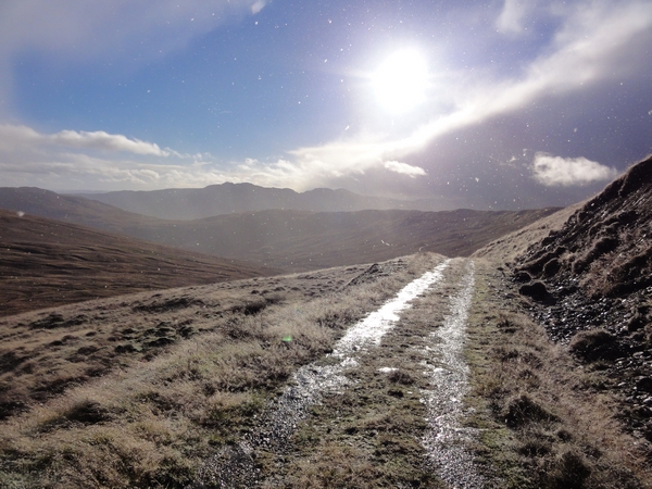
Glen Finglas Loop
Route: Glen Finglas LoopDistance: 16.4m / 26.3km
Profile: View
Grade: Moderate

Fitness: Moderate

Time: 4 - 5 Hours
OS MAP: 57
Route Data: GPX KML
Riders: Dave Banks, Brian Gray
Date: 03/11/2013
Summary
A mixture of single track, tarmac road and landrover track make this, in places, a hard, but rewarding mountain bike trek through interesting scenery.
Details
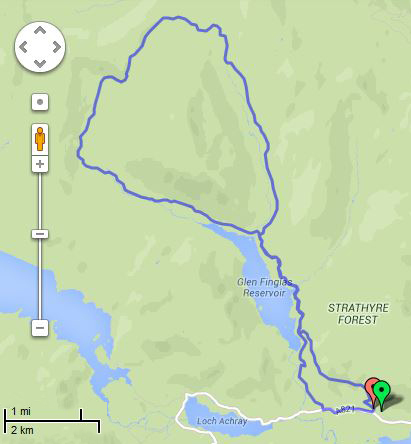
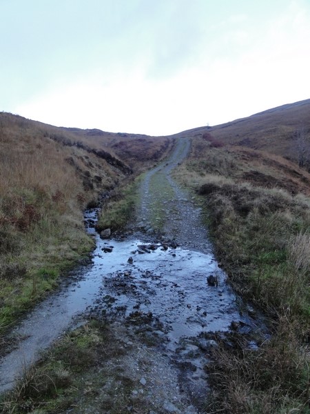
Starting at the Glen Finglas Scottish Woodlands Trust car park, just outside Brig o' Turk, follow the sign posts for the woodland walk out of the car park and across the footbridge. Once through the gate, the track turns to the left and after a short distance starts to climb quite steeply through the trees. Traction can be a problem, so some bike and hike may be required. The track then doubles back on itself and as it heads out of the trees the surface becomes loose stones which again caused problems with traction, so more bike and hike is required.
Once the viewpoint is reached, nice views of Loch Venachar are to be had, before the track continues its climb. There is a sign pointing to the right that takes you back to the car park, ignore this sign and continue to the left and up towards the second viewpoint. The track starts to level off before heading downhill across a bridge before yet another steep climb that may involve more bike and hike due to traction problems on the loose stony surface. The track becomes grassier and levels off and the views of Loch Venachar can now be appreciated. The track continues to gently climb, but soon starts to descend towards the tarmac road into Glen Finglas.
Turn to the right and follow the undulating road into the glen where you can appreciate the view of the hills and the reservoir. There are a couple of gates to negotiate, after the second gate, the road turns into a landrover track and starts climbing yet again. The landrover track is reasonably smooth with the occasional pothole. A stone compass feature at the side of the road is worth a quick visit.
A Y junction soon appears, the best way is to take the track to Balquhidder as the track has a gentler climb as it heads up the glen. Near the head of the glen, another junction appears, turn to the right here and continue on the Balquhidder path up the hill. When you see the "Hill Path to Balquhidder" marker stone, keep to the landrover track as it climbs, steeply at times and level at other points, up to the summit. The final summit section is quite steep and more bike and hike may be required.
Adjust your suspension and check your brakes as after the summit, the track drops quite steeply at first back down to the valley floor. The descent down to the valley floor and the river crossing takes only 15 minutes, your brakes will be working hard to keep your speed under control. After the river crossing the track levels off before climbing again, another 25 minutes and you are back at the Y junction. It took 1Hr 40Min, from the Y junction to the summit, and 40 minutes to return, so you get an idea of how steep the gradients are.
From the Y junction, the route is just the reverse of the outbound journey, except instead of turning back onto the single track over the hill, we took the faster and easier route to Brig o' Turk due to the fact we were quite cold and still a bit wet. From there turn left onto the main road and after about a 0.5m / 1km, the car park entrance appears.
Photo Gallery

